File:Garukemap-300dpi.tif
From OpenWetWare
Jump to navigationJump to search

Size of this PNG preview of this TIF file: 749 × 600 pixels. Other resolution: 2,557 × 2,048 pixels.
Original file (3,216 × 2,576 pixels, file size: 23.73 MB, MIME type: image/tiff)
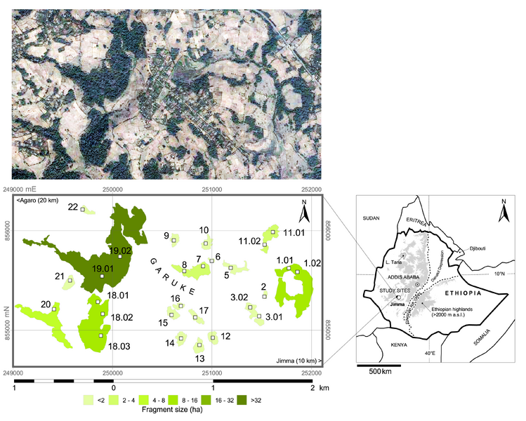
Map of Garuke with indication of forest fragments (shaded according to size) and plots where biotic and abiotic variables have been recorded in 2008 (TIF version)
File history
Click on a date/time to view the file as it appeared at that time.
| Date/Time | Thumbnail | Dimensions | User | Comment | |
|---|---|---|---|---|---|
| current | 12:17, 3 September 2009 |  | 3,216 × 2,576 (23.73 MB) | Raf Aerts (talk | contribs) | Map of Garuke with indication of forest fragments (shaded according to size) and plots where biotic and abiotic variables have been recorded in 2008 (TIF version) |
You cannot overwrite this file.
File usage
The following page uses this file:
