File:TopographicalMap.jpeg
From OpenWetWare
Jump to navigationJump to search
No higher resolution available.
TopographicalMap.jpeg (444 × 371 pixels, file size: 54 KB, MIME type: image/jpeg)
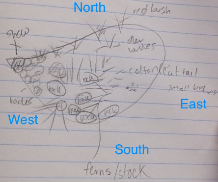
A topographical aerial map of transect.
File history
Click on a date/time to view the file as it appeared at that time.
| Date/Time | Thumbnail | Dimensions | User | Comment | |
|---|---|---|---|---|---|
| current | 03:32, 26 January 2015 | | 444 × 371 (54 KB) | Sophia C Zbesko (talk | contribs) | A topographical aerial map of transect. |
You cannot overwrite this file.
File usage
The following 2 files are duplicates of this file (more details):
There are no pages that use this file.
